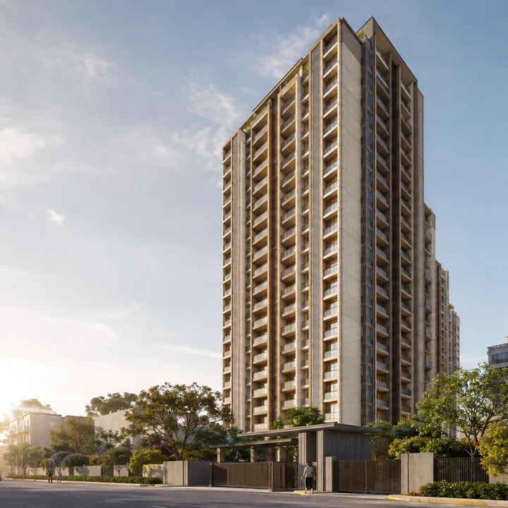
Urbanrise Gattahalli Masterplan
No master plan has been published for this project. What does exist is a single government filing that states, in numbers, how much land the scheme occupies, how much floor area it proposes to build, how many homes it contains and how tall the buildings go. This page works from that filing and says plainly where it stops. From a planning angle, Abhee Bellary Road keeps the reference local: internal roads, open-space placement, amenity access, and tower orientation all affect how the address will live after handover.
Urbanrise Gattahalli is the working title used on this site. Urbanrise has not announced a marketing name for the development, and none of the campaign names circulating for other Urbanrise schemes belongs to this one.
What the filing establishes about the Urbanrise Gattahalli site
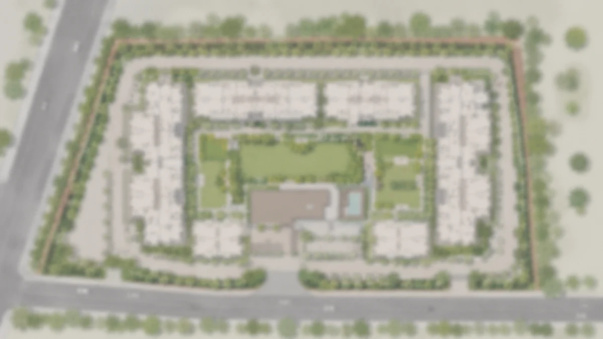 Indicative master plan, the filed 4.20 acres — Urbanrise Gattahalli
These figures come from proposal SIA/KA/INFRA2/583353/2026, a fresh environmental clearance application under activity 8(a) Building and Construction, filed by Alliance Grandeur Homes Private Limited on 7 July 2026. Its status is under verification.
| Item | Filed value |
|---|---|
| Land area | 1.6996 hectares = 4.20 acres |
| Built-up area | 79,634.39 sq m |
| Residential units | 368 |
| Residential floor configuration | 2BF + GF + 18UF |
| Club house configuration | 2BF + GF + 2UF |
| Project name on file | Development of "Residential Apartment and Club House" Project |
| Survey number | Sy. No. 50, Gattahalli Village, Sarjapura Hobli, Anekal Taluk |
| Category | B2, before SEIAA |
| Declared project cost | Rs 223.80 crore |
| Single-window references | SW/287832/2026 · CAF/273411/2026 |
Two things about that table matter more than any individual number. The first is that it is a proposal, not a permission. The environmental application was filed on 7 July 2026 and is under verification. No environmental clearance has been granted, no terms of reference have been issued, and the project is not registered with the Karnataka Real Estate Regulatory Authority. Nothing here has been approved, cleared or sanctioned.
The second is that the filed programme names the clubhouse in the project title itself. The scheme was described to the regulator as an apartment and club house project, and the clubhouse carries its own floor configuration. That is unusual enough to be worth noticing, and we return to it below.
The 4.20-acre parcel at Sy. No. 50
The scheme sits on a single survey number. Land area is stated as 1.6996 hectares, which is 16,996 sq m, which converts to 4.20 acres at 4,046.86 sq m to the acre. That is the figure the promoter put before the regulator, and it is the only site area we publish.
The promoter uploaded a site-boundary file to the portal. Its corner extents describe a box roughly 193 m by 176 m on the ground. We publish the centre of that box as the site pin: 12.87146, 77.70101. That is our own derivation from the filed boundary rather than a coordinate the developer has published, and we hold it at medium-to-high confidence.
One reading follows from the box, and it is ours rather than the filing's. A 193 m by 176 m rectangle encloses roughly 34,000 sq m, about twice the 16,996 sq m the promoter declares. A parcel that fills only about half of its own bounding box is not a north-aligned rectangle. It is either rotated against the compass or irregular in outline — a plot with an angled or stepped boundary rather than a neat square. Treat that as an estimate drawn from rounded corner values, not as a description of the plot's shape. The actual polygon has not been published as a drawing, and until a sanctioned plan appears, nobody outside the promoter's design team knows how the buildings are turned on the land.
What 79,634.39 sq m of built-up area means here
The filed built-up area converts to roughly 857,000 sq ft at 10.7639 sq ft to the square metre. Set beside 368 homes, that is a large number, and the arithmetic is worth doing carefully because it is easy to misread.
| Derivation | Working | Result |
|---|---|---|
| Built-up area per home | 79,634.39 ÷ 368 | about 216.4 sq m, or roughly 2,330 sq ft |
| Built-up area to land area | 79,634.39 ÷ 16,996 | about 4.69 |
| Land share per home | 16,996 ÷ 368 | about 46.2 sq m, or roughly 497 sq ft |
All three are our own estimates, derived from the two filed figures. None of them is a specification.
The first line is the one most likely to be misunderstood. Built-up area in an environmental filing is a gross number. It counts basements, parking decks, ramps, lift cores, corridors, staircases, services, walls and the clubhouse. It is not saleable area and it is certainly not carpet area. The client brief circulates a tentative configuration table — 2 BHK at 1,100 to 1,250 sq ft and 3 BHK at 1,300 to 1,615 sq ft, self-labelled tentative and unverified by us. If those sizes were to hold, the gap between roughly 2,330 sq ft of gross built-up area per home and an apartment of 1,100 to 1,615 sq ft is where two basements of parking, the circulation cores, the services and the clubhouse live. That gap is normal. It is also the reason a buyer should never read a built-up area figure as an indication of apartment size.
The second line is a ratio, not a floor area ratio. Sanctioned FAR is calculated to a planning authority's own rules, which commonly exclude basement parking and some service areas from the count. Our 4.69 includes everything the promoter declared. The sanctioned FAR, when a plan is approved, will be a different and almost certainly lower number. We publish the ratio only because it is a fair measure of how intensively the parcel is being used.
Floors at Urbanrise Gattahalli: two basements, ground and eighteen above
The residential configuration on file is 2BF + GF + 18UF — two basement floors, a ground floor and eighteen upper floors. That is nineteen levels at or above ground and two below.
Basements on a site this size ordinarily carry parking, water tanks, pumps, generator rooms and similar services. That is a reading of a standard configuration rather than something the filing states, and it should be checked against the sanctioned plan when one exists. Two basement levels on a 4.20-acre parcel is a meaningful commitment of construction cost, and it usually means the developer intends to keep the ground plane comparatively free of cars.
Material in circulation puts the maximum height at 56.45 m. That figure is unverified and we attribute it rather than assert it. As a plausibility check only: 56.45 m spread over nineteen levels above ground works out to about 2.97 m of floor-to-floor height per level, which is a normal apartment dimension. That arithmetic tests the claim for internal consistency. It does not confirm it.
We publish no tower count. The filing states none. The number of blocks, how the 368 homes are divided between them, and how many apartments share a lift core are all unknown, and they are among the most consequential unknowns on this page. As a scale marker, and as our own arithmetic: if the ground floor carries no apartments, 368 homes across eighteen upper floors averages about 20.4 homes per upper floor for the development as a whole. That figure says something about the total scheme and nothing at all about any single corridor. Twenty homes per floor in one block is a very different building from twenty homes spread over three. Until a block layout is published, a buyer cannot tell which of those they would be living in.
The clubhouse: a separate building at 2BF + GF + 2UF
The filing gives the club house its own configuration — two basement floors, a ground floor and two upper floors. Five levels, in a building the filing treats as distinct from the residential blocks. The project was registered with the regulator under a name that includes the clubhouse.
On a 4.20-acre site, a dedicated five-level amenity building is a genuine commitment rather than a marketing line. It is structurally different from the common alternative, where amenity space is carved out of a podium or a tower's lower floors and shares its structure and services with apartments. A standalone building can hold the plant a pool and a gym need, can be operated on its own hours, and keeps noise away from bedrooms.
What the filing does not give is the clubhouse's floor area, its facilities, or where it sits on the plot. The brief carries an area figure, which we handle in the unverified section below. No amenity schedule has been published by Urbanrise or by Alliance Grandeur Homes, and the generic amenity list attached to the material we received could not be tied to this project, so we do not publish it as this scheme's amenity set.
Density at Urbanrise Gattahalli, and what it implies
This is the arithmetic that shapes daily life on the site more than any other, so we set it out in full. All of it is our own derivation from the two filed figures, and all of it is an estimate.
| Derivation | Working | Result |
|---|---|---|
| Homes per acre | 368 ÷ 4.20 | about 87.6 |
| Homes per hectare | 368 ÷ 1.6996 | about 216.5 |
| Land per home | 16,996 ÷ 368 | about 46.2 sq m |
Roughly 87.6 homes per acre is dense. It is the density of a vertical scheme, not a garden one. With about 46 sq m of land per home in total — before a single square metre is given to the buildings themselves, the driveways, the ramps, the setbacks or the services — the ground plane will be tightly organised, and the open space that residents actually use is likely to be shared, programmed and compact rather than expansive.
Both facts belong on the same page. The density is high. The five-level clubhouse is a real amenity commitment on that footprint, and it is the sort of provision that makes a dense scheme workable rather than cramped. A buyer looking at this project should weigh those against each other directly, and should ask to see how the ground level is planned before deciding.
We deliberately do not divide the declared project cost of Rs 223.80 crore by 368 homes or by the built-up area. A project cost declared to an environmental regulator is not a sale price, and a per-home or per-sq-ft figure derived from it would look like a rate while meaning nothing to a buyer. Urbanrise has published no price for this project, and we publish none.
The client brief's site-planning claims — attributed, and unverified
Everything in this section comes from the client brief supplied to us. None of it appears in the government filing, and none of it has been published by Urbanrise or by Alliance Grandeur Homes. We set it out in full here, because a buyer is entitled to see what is being said about the scheme. We do not assert any of it. The services and sustainability items in the same block are also recorded, attributed and unverified, on the amenities page; nowhere on this site is any of it presented as a specification for this project.
| Claim in the brief | Figure | Our arithmetic on it |
|---|---|---|
| Landscape area | 4,470.47 sq m | about 26.30% of the 16,996 sq m site |
| Park | 1,691 sq m | about 0.42 acre; roughly 37.8% of the claimed landscape area |
| Clubhouse area | 1,337.85 sq m | about 14,400 sq ft; roughly 3.6 sq m (39 sq ft) per home |
| Car parking | 432 spaces | about 1.17 spaces per home |
| EV charging provisions | 92, described as 25% of parking | 92 of 432 is 21.3%, not 25% |
| Sewage treatment plant | 300 KLD, SBR process | about 815 litres per home per day |
| Rainwater recharge pits | 29 | one pit per about 586 sq m of site, or per about 12.7 homes |
| Power saving | 26.30% | no connected load figure is attributable, so we publish none |
| Other services | solar water heaters and photovoltaics | no capacity figure is attributable |
| Maximum height | 56.45 m | about 2.97 m per level over nineteen levels |
| Site access | direct from the 9 m Gattahalli Main Road | see below |
Taken one at a time, here is what each would mean for a resident if it held.
Landscape at 26.30% of the site. Just over a quarter of the parcel as soft landscape would be a reasonable figure for a scheme at this density, and it would mean a resident on an upper floor looks down on greenery rather than on parked cars. Note that the percentage is our own division of the brief's area figure by the filed site area, and that it happens to be numerically identical to the brief's separate power-saving claim. We record that coincidence without drawing any conclusion from it. Both remain unverified.
A 1,691 sq m park. At about 0.42 acre it would be a single usable open space rather than a set of leftover strips, which matters far more than a total landscape percentage. Whether it reads as a park or as a lawn depends entirely on where it sits relative to the blocks, and no plan shows that.
432 parking spaces for 368 homes. About 1.17 spaces per home means the majority of apartments would get one space, with a limited pool beyond that. For a 2 and 3 BHK scheme on a corridor where most households drive to work, that is tight. Visitor parking, if it comes out of the same 432, makes it tighter. This is a question to put to the developer in writing.
92 EV charging provisions. The brief's own two figures do not agree with each other: 92 of 432 spaces is 21.3%, and a genuine 25% of 432 would be 108. That is not a large discrepancy, but it is the kind of internal inconsistency that shows the numbers were assembled rather than measured, and it is one reason we treat the whole block as unverified. Note also that a charging "provision" usually means conduit and load allocation, not an installed charger.
A 300 KLD sewage treatment plant. Spread across 368 homes that is about 815 litres per home per day of treatment capacity. What matters to a resident is less the headline number than where the plant sits, how it is enclosed, and whether treated water is actually reused for landscape and flushing. None of that is published.
29 recharge pits. One pit per roughly 586 sq m of site. Recharge pits only work if they are maintained and if the stormwater actually reaches them, which is a maintenance question for the eventual owners' association rather than a construction one.
Access from a 9 m road. The brief describes access as direct from the 9 m Gattahalli Main Road. We cannot verify the width. If it is right, a nine-metre carriageway is narrow for a development of 368 homes, and it would be the single most important physical constraint on the site. Every construction vehicle during the build and every resident car afterwards would use it. Anyone considering this project should drive that approach at the evening peak before forming a view, and should ask whether any road widening is proposed under the Anekal planning authority's scheme.
What no published document shows for Urbanrise Gattahalli
The honest list of gaps is long, and it is worth stating rather than glossing over:
- No sanctioned building plan, and no sanctioning authority reference of any kind.
- No master-plan drawing, site plan or landscape plan.
- No block or tower count, and no distribution of the 368 homes between blocks.
- No unit mix by floor, no floor plate layout, and no confirmed apartment sizes.
- No setback, buffer or open-space distribution figures we can attribute to any source.
- No phasing statement, and no indication whether the clubhouse is built in the first phase.
- No launch or completion dates. The dates in circulating material are template defaults and we publish none.
Until a sanctioned plan exists, every layout question above is unanswerable, and any drawing presented as this project's master plan should be treated as an artist's impression rather than a sanctioned document.
Planning jurisdiction, and why it changes what to expect
The site tests outside the Greater Bengaluru Authority boundary, about 2.8 km east of its nearest edge, placing it in the BMRDA planning region under Anekal jurisdiction. That margin is thinner than it sounds, and the boundary is politically live, so it is worth confirming rather than assuming. In practical terms, buyers should expect panchayat khata and panchayat property tax rather than BBMP A-khata, and should confirm the khata classification on the specific survey number before purchase. It also means the plan sanction, when it comes, will come from the planning authority with jurisdiction over this parcel — a detail worth verifying on the sanction letter itself rather than in a brochure.
The regulatory position on this project
Urbanrise Gattahalli is not registered with the Karnataka Real Estate Regulatory Authority, and no application is pending in the registry. Section 3 of the Real Estate (Regulation and Development) Act 2016 bars a project in a registrable class from being advertised, marketed, booked or sold until registration has been granted. This microsite is an information and enquiry resource covering a scheme that is still at the approvals stage. It is not a booking channel, and no allotment, unit number or price can be agreed for this project at present.
Questions to ask when a master plan is published
When Urbanrise does release drawings, these are the points on which a published plan either holds up or does not:
- The sanctioned plan number, its date, and the authority that issued it — not a rendering.
- The number of blocks, and how many homes share each lift core on a typical floor.
- Whether the two basement levels actually deliver the parking count claimed, and what visitors get.
- Landscape shown as sanctioned open space, with dimensions, rather than as a percentage in a brochure.
- Where the sewage treatment plant, generator yard and refuse point sit relative to the nearest bedrooms.
- The access road's sanctioned width, and whether any widening is proposed.
- Whether the clubhouse is in the first phase, and what its handover condition is.
- The K-RERA registration number, once granted, and the sanctioned plan set filed with it.
Urbanrise Gattahalli Master Plan — frequently asked questions
No. Nothing has been granted. The environmental application was filed on 7 July 2026 and its status is UNDER VERIFICATION. There is no state file number, no certificate, no Terms of Reference and no Environmental Clearance on the record. There is also no K-RERA registration. A filed application is a request, not a permission, and the distinction is the whole point of this page. You can check the position yourself on the national PARIVESH portal under proposal number SIA/KA/INFRA2/583353/2026, with single-window reference SW/287832/2026 and CAF/273411/2026, where the issuing authority is the State Environment Impact Assessment Authority. We will not write "approved", "cleared" or "sanctioned" about this project, and we would encourage you to read any material that does with real suspicion.
368 residential units. That number is on the environmental filing, it matches the figure in the circulating brief, and it is one of the few things about this project we can state without hedging. What the filing does not do is break those 368 homes down by type, size or tower. So while the total is firm, everything downstream of it, including the unit mix and the configuration table, remains provisional until the developer publishes a sanctioned plan. A change in mix would not necessarily change the total, and a change in the total would require the promoter to go back to the authority.
No, and the correction changes the answer to both halves of the question. Circulating material names BBMP as the approving authority. We tested the corrected site centroid against the official Greater Bengaluru Authority boundary and against the five-corporation boundary set, and the site falls outside both; the test self-validates, since MG Road, Whitefield and Kudlu all register inside it. The site tests outside the Greater Bengaluru Authority boundary, about 2.8 km east of its nearest edge, placing it in the BMRDA planning region under Anekal jurisdiction. Expect B-khata or panchayat khata and panchayat property tax rather than BBMP A-khata, a difference that affects lending appetite and resale liquidity. Two qualifications: that 2.8 km margin is thinner than a casual reading suggests, and BBMP was dissolved into the Greater Bengaluru Authority on 2 September 2025, so the boundary is politically live. Confirm the khata classification on this survey number before purchase.
We publish no tower count, because the filing does not state one. Circulating material does carry a tower count, but it is the client brief's number rather than a filed one, and a tower count is precisely the sort of detail that shifts between a first application and a sanctioned plan, so we leave it out rather than lend it authority. What is on the record is the vertical form: 2 basements, ground floor and 18 upper floors for the residential blocks, and 2 basements, ground and 2 upper floors for the club house. The brief also puts maximum height at 56.45 m, which we attribute to the brief and do not assert. Eighteen upper floors is high-rise construction and carries the fire-safety and lift-provision requirements that go with it.
The client brief sets out 2 BHK homes of about 1,100 to 1,250 sq ft and 3 BHK homes of about 1,300 to 1,615 sq ft. The brief labels that table "tentative" itself, and we present it the same way: as the brief's provisional mix, not as specification. Nothing in the environmental filing corroborates any unit size. Until a plan is sanctioned and the project is registered, a configuration table is a design intention, not a commitment. If you are budgeting around a particular carpet area, treat these ranges as a rough shape of the product rather than as numbers to plan a loan against.
Enquire about Urbanrise Gattahalli
Urbanrise Gattahalli is at the stage where the useful thing is information rather than a booking, because there is no lawful booking to make. Leave your details and we will tell you when the position changes — when a Karnataka RERA number is issued, when the environmental file moves, and when the developer publishes a price, a floor plate and an amenity schedule. The enquiry form asks for a name, phone number, email address and message; name and phone are required.